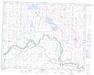
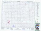
Maps showing Eagle Lake, 23-24-W4, Alberta
Eagle Lake is a Lake located in 23-24-W4, Alberta and has an elevation of 924 meters.
- Latitude: 50° 49' 48'' North (decimal: 50.8300000)
- Longitude: 113° 19' 27'' West (decimal: -113.3241666)
- Topography Feature Category: Lake
- Geographical Feature: Lake
- Canadian Province/Territory: Alberta
- Elevation: 924 meters
- Location: 23-24-W4
- Atlas of Canada Locator Map: Eagle Lake
- GPS Coordinate Locator Map: Eagle Lake Lat/Long
Eagle Lake NTS Map Sheets