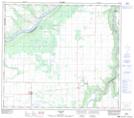
Maps showing Eaglesham, 25-78-26-W5, Alberta
Eaglesham is a Unincorporated area located in 25-78-26-W5, Alberta and has an elevation of 571 meters.
- Latitude: 55° 46' 57'' North (decimal: 55.7824999)
- Longitude: 117° 53' 00'' West (decimal: -117.8832999)
- Topography Feature Category: Unincorporated area
- Geographical Feature: Locality
- Canadian Province/Territory: Alberta
- Elevation: 571 meters
- Location: 25-78-26-W5
- Atlas of Canada Locator Map: Eaglesham
- GPS Coordinate Locator Map: Eaglesham Lat/Long