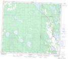
Maps showing Lahaieville, 14-67-24-W4, Alberta
Lahaieville is a Unincorporated area located in 14-67-24-W4, Alberta and has an elevation of 598 meters.
- Latitude: 54° 47' 59'' North (decimal: 54.7997222)
- Longitude: 113° 33' 54'' West (decimal: -113.5649999)
- Topography Feature Category: Unincorporated area
- Geographical Feature: Locality
- Canadian Province/Territory: Alberta
- Elevation: 598 meters
- Location: 14-67-24-W4
- Atlas of Canada Locator Map: Lahaieville
- GPS Coordinate Locator Map: Lahaieville Lat/Long