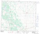
Maps showing Elbridge, 22-60-22-W4, Alberta
Elbridge is a Unincorporated area located in 22-60-22-W4, Alberta and has an elevation of 662 meters.
- Latitude: 54° 12' 38'' North (decimal: 54.2105555)
- Longitude: 113° 13' 36'' West (decimal: -113.2266667)
- Topography Feature Category: Unincorporated area
- Geographical Feature: Locality
- Canadian Province/Territory: Alberta
- Elevation: 662 meters
- Location: 22-60-22-W4
- Atlas of Canada Locator Map: Elbridge
- GPS Coordinate Locator Map: Elbridge Lat/Long