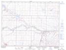
Maps showing Coutts, 4-1-15-W4, Alberta
Coutts is a Village located in 4-1-15-W4, Alberta and has an elevation of 1067 meters.
- Latitude: 49° 0' 10'' North (decimal: 49.0027778)
- Longitude: 111° 57' 32'' West (decimal: -111.9588889)
- Topography Feature Category: Village
- Geographical Feature: Village
- Canadian Province/Territory: Alberta
- Elevation: 1067 meters
- Location: 4-1-15-W4
- Atlas of Canada Locator Map: Coutts
- GPS Coordinate Locator Map: Coutts Lat/Long