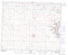
Maps showing Elnora, 10-35-23-W4, Alberta
Elnora is a Village located in 10-35-23-W4, Alberta and has an elevation of 935 meters.
- Latitude: 51° 59' 26'' North (decimal: 51.9905555)
- Longitude: 113° 12' 3'' West (decimal: -113.2008332)
- Topography Feature Category: Village
- Geographical Feature: Village
- Canadian Province/Territory: Alberta
- Elevation: 935 meters
- Location: 10-35-23-W4
- Atlas of Canada Locator Map: Elnora
- GPS Coordinate Locator Map: Elnora Lat/Long