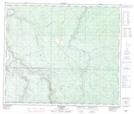
Maps showing Karr Lake, 16,17-64-2-W6, Alberta
Karr Lake is a Lake located in 16,17-64-2-W6, Alberta and has an elevation of 863 meters.
- Latitude: 54° 32' 18'' North (decimal: 54.5383333)
- Longitude: 118° 15' 18'' West (decimal: -118.2550000)
- Topography Feature Category: Lake
- Geographical Feature: Lake
- Canadian Province/Territory: Alberta
- Elevation: 863 meters
- Location: 16,17-64-2-W6
- Atlas of Canada Locator Map: Karr Lake
- GPS Coordinate Locator Map: Karr Lake Lat/Long