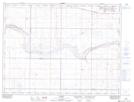
Maps showing Legend, 19-6-12-W4, Alberta
Legend is a Unincorporated area located in 19-6-12-W4, Alberta and has an elevation of 897 meters.
- Latitude: 49° 29' 4'' North (decimal: 49.4844444)
- Longitude: 111° 36' 35'' West (decimal: -111.6097222)
- Topography Feature Category: Unincorporated area
- Geographical Feature: Locality
- Canadian Province/Territory: Alberta
- Elevation: 897 meters
- Location: 19-6-12-W4
- Atlas of Canada Locator Map: Legend
- GPS Coordinate Locator Map: Legend Lat/Long