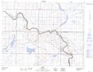
Maps showing Bad Land Hills, 13-13-W4, Alberta
Bad Land Hills is a Mountain located in 13-13-W4, Alberta and has an elevation of 803 meters.
- Latitude: 50° 4' 57'' North (decimal: 50.0824999)
- Longitude: 111° 45' 45'' West (decimal: -111.7625000)
- Topography Feature Category: Mountain
- Geographical Feature: Hills
- Canadian Province/Territory: Alberta
- Elevation: 803 meters
- Location: 13-13-W4
- Atlas of Canada Locator Map: Bad Land Hills
- GPS Coordinate Locator Map: Bad Land Hills Lat/Long