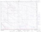
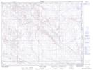
Maps showing Bare Creek, 25-3-1-W4, Alberta
Bare Creek is a River located in 25-3-1-W4, Alberta and has an elevation of 1055 meters.
- Latitude: 49° 14' 4'' North (decimal: 49.2344444)
- Longitude: 110° 0' 52'' West (decimal: -110.0144443)
- Topography Feature Category: River
- Geographical Feature: Creek
- Canadian Province/Territory: Alberta
- Elevation: 1055 meters
- Location: 25-3-1-W4
- Atlas of Canada Locator Map: Bare Creek
- GPS Coordinate Locator Map: Bare Creek Lat/Long
Bare Creek NTS Map Sheets