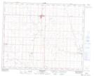
Maps showing Bargrave, 9-30-25-W4, Alberta
Bargrave is a Unincorporated area located in 9-30-25-W4, Alberta and has an elevation of 878 meters.
- Latitude: 51° 32' 53'' North (decimal: 51.5480555)
- Longitude: 113° 28' 23'' West (decimal: -113.4730556)
- Topography Feature Category: Unincorporated area
- Geographical Feature: Locality
- Canadian Province/Territory: Alberta
- Elevation: 878 meters
- Location: 9-30-25-W4
- Atlas of Canada Locator Map: Bargrave
- GPS Coordinate Locator Map: Bargrave Lat/Long
Bargrave NTS Map Sheets