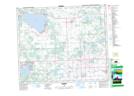
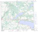
Maps showing Farming Island, 3-55-4-W5, Alberta
Farming Island is a Island located in 3-55-4-W5, Alberta and has an elevation of 723 meters.
- Latitude: 53° 43' 10'' North (decimal: 53.7194444)
- Longitude: 114° 30' 24'' West (decimal: -114.5066667)
- Topography Feature Category: Island
- Geographical Feature: Island
- Canadian Province/Territory: Alberta
- Elevation: 723 meters
- Location: 3-55-4-W5
- Atlas of Canada Locator Map: Farming Island
- GPS Coordinate Locator Map: Farming Island Lat/Long
Farming Island NTS Map Sheets