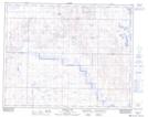
Maps showing Farrell Creek, 33-18-W4, Alberta
Farrell Creek is a River located in 33-18-W4, Alberta and has an elevation of 840 meters.
- Latitude: 51° 52' 57'' North (decimal: 51.8825000)
- Longitude: 112° 24' 46'' West (decimal: -112.4127777)
- Topography Feature Category: River
- Geographical Feature: Creek
- Canadian Province/Territory: Alberta
- Elevation: 840 meters
- Location: 33-18-W4
- Atlas of Canada Locator Map: Farrell Creek
- GPS Coordinate Locator Map: Farrell Creek Lat/Long
Farrell Creek NTS Map Sheets