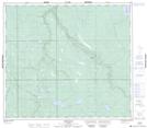
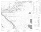
Maps showing Dorothy Island, 87-4-W4, Alberta
Dorothy Island is a Island located in 87-4-W4, Alberta and has an elevation of 449 meters.
- Latitude: 56° 30' 38'' North (decimal: 56.5105555)
- Longitude: 110° 31' 23'' West (decimal: -110.5230555)
- Topography Feature Category: Island
- Geographical Feature: Island
- Canadian Province/Territory: Alberta
- Elevation: 449 meters
- Location: 87-4-W4
- Atlas of Canada Locator Map: Dorothy Island
- GPS Coordinate Locator Map: Dorothy Island Lat/Long
Dorothy Island NTS Map Sheets