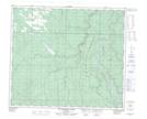
Maps showing Dorscheid, 5-67-4-W6, Alberta
Dorscheid is a Unincorporated area located in 5-67-4-W6, Alberta and has an elevation of 712 meters.
- Latitude: 54° 46' 17'' North (decimal: 54.7713889)
- Longitude: 118° 34' 34'' West (decimal: -118.5761111)
- Topography Feature Category: Unincorporated area
- Geographical Feature: Railway Point
- Canadian Province/Territory: Alberta
- Elevation: 712 meters
- Location: 5-67-4-W6
- Atlas of Canada Locator Map: Dorscheid
- GPS Coordinate Locator Map: Dorscheid Lat/Long
Dorscheid NTS Map Sheets