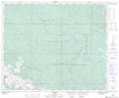
Maps showing Leyland, 8-47-23-W5, Alberta
Leyland is a Unincorporated area located in 8-47-23-W5, Alberta and has an elevation of 1530 meters.
- Latitude: 53° 2' 10'' North (decimal: 53.0361111)
- Longitude: 117° 19' 18'' West (decimal: -117.3216667)
- Topography Feature Category: Unincorporated area
- Geographical Feature: Locality
- Canadian Province/Territory: Alberta
- Elevation: 1530 meters
- Location: 8-47-23-W5
- Atlas of Canada Locator Map: Leyland
- GPS Coordinate Locator Map: Leyland Lat/Long