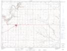
Maps showing Linquist Coulee, 7-12-10-W4, Alberta
Linquist Coulee is a Valley located in 7-12-10-W4, Alberta and has an elevation of 771 meters.
- Latitude: 49° 58' 44'' North (decimal: 49.9788889)
- Longitude: 111° 21' 48'' West (decimal: -111.3633333)
- Topography Feature Category: Valley
- Geographical Feature: Coulee
- Canadian Province/Territory: Alberta
- Elevation: 771 meters
- Location: 7-12-10-W4
- Atlas of Canada Locator Map: Linquist Coulee
- GPS Coordinate Locator Map: Linquist Coulee Lat/Long
Linquist Coulee NTS Map Sheets