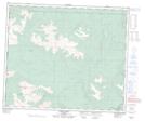
Maps showing Base Line Lake, 60,61-13-W6, Alberta
Base Line Lake is a Lake located in 60,61-13-W6, Alberta and has an elevation of 1273 meters.
- Latitude: 54° 14' 15'' North (decimal: 54.2374999)
- Longitude: 119° 50' 42'' West (decimal: -119.8450000)
- Topography Feature Category: Lake
- Geographical Feature: Lake
- Canadian Province/Territory: Alberta
- Elevation: 1273 meters
- Location: 60,61-13-W6
- Atlas of Canada Locator Map: Base Line Lake
- GPS Coordinate Locator Map: Base Line Lake Lat/Long