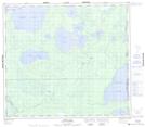
Maps showing Baker Lake, 4,5,8,9-86-1-w4, Alberta
Baker Lake is a Lake located in 4,5,8,9-86-1-w4, Alberta and has an elevation of 497 meters.
- Latitude: 56° 26' 1'' North (decimal: 56.4336110)
- Longitude: 110° 7' 10'' West (decimal: -110.1194444)
- Topography Feature Category: Lake
- Geographical Feature: Lake
- Canadian Province/Territory: Alberta
- Elevation: 497 meters
- Location: 4,5,8,9-86-1-w4
- Atlas of Canada Locator Map: Baker Lake
- GPS Coordinate Locator Map: Baker Lake Lat/Long
Baker Lake NTS Map Sheets