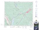
Maps showing Prine Creek, 50-27-W5, Alberta
Prine Creek is a River located in 50-27-W5, Alberta and has an elevation of 1184 meters.
- Latitude: 53° 21' 24'' North (decimal: 53.3566666)
- Longitude: 117° 51' 18'' West (decimal: -117.8549999)
- Topography Feature Category: River
- Geographical Feature: Creek
- Canadian Province/Territory: Alberta
- Elevation: 1184 meters
- Location: 50-27-W5
- Atlas of Canada Locator Map: Prine Creek
- GPS Coordinate Locator Map: Prine Creek Lat/Long