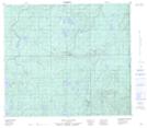
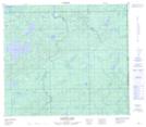
Maps showing Landels River, 80-2-W4, Alberta
Landels River is a River located in 80-2-W4, Alberta and has an elevation of 569 meters.
- Latitude: 55° 57' 47'' North (decimal: 55.9630555)
- Longitude: 110° 14' 58'' West (decimal: -110.2494443)
- Topography Feature Category: River
- Geographical Feature: River
- Canadian Province/Territory: Alberta
- Elevation: 569 meters
- Location: 80-2-W4
- Atlas of Canada Locator Map: Landels River
- GPS Coordinate Locator Map: Landels River Lat/Long
Landels River NTS Map Sheets