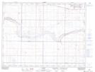
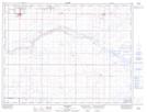
Maps showing Legend Coulee, 24-5-12-W4, Alberta
Legend Coulee is a Valley located in 24-5-12-W4, Alberta and has an elevation of 890 meters.
- Latitude: 49° 23' 44'' North (decimal: 49.3955555)
- Longitude: 111° 29' 55'' West (decimal: -111.4986111)
- Topography Feature Category: Valley
- Geographical Feature: Coulee
- Canadian Province/Territory: Alberta
- Elevation: 890 meters
- Location: 24-5-12-W4
- Atlas of Canada Locator Map: Legend Coulee
- GPS Coordinate Locator Map: Legend Coulee Lat/Long
Legend Coulee NTS Map Sheets