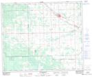
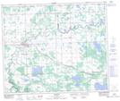
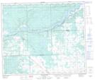
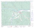
Maps showing Little Paddle River, 23-57-7-W5, Alberta
Little Paddle River is a River located in 23-57-7-W5, Alberta and has an elevation of 664 meters.
- Latitude: 53° 56' 50'' North (decimal: 53.9472221)
- Longitude: 114° 56' 37'' West (decimal: -114.9436110)
- Topography Feature Category: River
- Geographical Feature: River
- Canadian Province/Territory: Alberta
- Elevation: 664 meters
- Location: 23-57-7-W5
- Atlas of Canada Locator Map: Little Paddle River
- GPS Coordinate Locator Map: Little Paddle River Lat/Long
Little Paddle River NTS Map Sheets