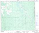
Maps showing Little Prairie Creek, 70-16-W5, Alberta
Little Prairie Creek is a River located in 70-16-W5, Alberta and has an elevation of 724 meters.
- Latitude: 55° 4' 19'' North (decimal: 55.0719444)
- Longitude: 116° 20' 26'' West (decimal: -116.3405556)
- Topography Feature Category: River
- Geographical Feature: Creek
- Canadian Province/Territory: Alberta
- Elevation: 724 meters
- Location: 70-16-W5
- Atlas of Canada Locator Map: Little Prairie Creek
- GPS Coordinate Locator Map: Little Prairie Creek Lat/Long
Little Prairie Creek NTS Map Sheets