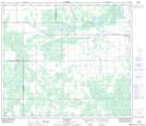
Maps showing Little Smoky, 29-74-19-W5, Alberta
Little Smoky is a Unincorporated area located in 29-74-19-W5, Alberta and has an elevation of 585 meters.
- Latitude: 55° 25' 56'' North (decimal: 55.4322222)
- Longitude: 116° 52' 23'' West (decimal: -116.8730556)
- Topography Feature Category: Unincorporated area
- Geographical Feature: Locality
- Canadian Province/Territory: Alberta
- Elevation: 585 meters
- Location: 29-74-19-W5
- Atlas of Canada Locator Map: Little Smoky
- GPS Coordinate Locator Map: Little Smoky Lat/Long