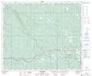
Maps showing Little Sundance Creek, 53-18-W5, Alberta
Little Sundance Creek is a River located in 53-18-W5, Alberta and has an elevation of 1024 meters.
- Latitude: 53° 33' 25'' North (decimal: 53.5569444)
- Longitude: 116° 35' 35'' West (decimal: -116.5930556)
- Topography Feature Category: River
- Geographical Feature: Creek
- Canadian Province/Territory: Alberta
- Elevation: 1024 meters
- Location: 53-18-W5
- Atlas of Canada Locator Map: Little Sundance Creek
- GPS Coordinate Locator Map: Little Sundance Creek Lat/Long