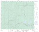
Maps showing Little Sundance Lake, 11-55-21-W5, Alberta
Little Sundance Lake is a Lake located in 11-55-21-W5, Alberta and has an elevation of 1077 meters.
- Latitude: 53° 44' 16'' North (decimal: 53.7377777)
- Longitude: 117° 0' 46'' West (decimal: -117.0127778)
- Topography Feature Category: Lake
- Geographical Feature: Lake
- Canadian Province/Territory: Alberta
- Elevation: 1077 meters
- Location: 11-55-21-W5
- Atlas of Canada Locator Map: Little Sundance Lake
- GPS Coordinate Locator Map: Little Sundance Lake Lat/Long