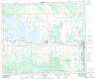
Maps showing Lobstick, 30-53-8-W5, Alberta
Lobstick is a Unincorporated area located in 30-53-8-W5, Alberta and has an elevation of 785 meters.
- Latitude: 53° 36' 17'' North (decimal: 53.6047221)
- Longitude: 115° 9' 48'' West (decimal: -115.1633332)
- Topography Feature Category: Unincorporated area
- Geographical Feature: Locality
- Canadian Province/Territory: Alberta
- Elevation: 785 meters
- Location: 30-53-8-W5
- Atlas of Canada Locator Map: Lobstick
- GPS Coordinate Locator Map: Lobstick Lat/Long
Lobstick NTS Map Sheets