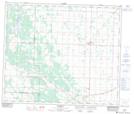
Maps showing Abee, 1-61-21-W4, Alberta
Abee is a Unincorporated area located in 1-61-21-W4, Alberta and has an elevation of 667 meters.
- Latitude: 54° 14' 16'' North (decimal: 54.2377777)
- Longitude: 113° 1' 40'' West (decimal: -113.0277778)
- Topography Feature Category: Unincorporated area
- Geographical Feature: Hamlet
- Canadian Province/Territory: Alberta
- Elevation: 667 meters
- Location: 1-61-21-W4
- Atlas of Canada Locator Map: Abee
- GPS Coordinate Locator Map: Abee Lat/Long