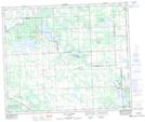
Maps showing Belvedere, 10-58-3-W5, Alberta
Belvedere is a Unincorporated area located in 10-58-3-W5, Alberta and has an elevation of 645 meters.
- Latitude: 53° 59' 6'' North (decimal: 53.9850000)
- Longitude: 114° 20' 58'' West (decimal: -114.3494444)
- Topography Feature Category: Unincorporated area
- Geographical Feature: Locality
- Canadian Province/Territory: Alberta
- Elevation: 645 meters
- Location: 10-58-3-W5
- Atlas of Canada Locator Map: Belvedere
- GPS Coordinate Locator Map: Belvedere Lat/Long
Belvedere NTS Map Sheets