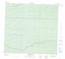
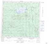
Maps showing Rainbow Lake, 107-8,9-W6, Alberta
Rainbow Lake is a Lake located in 107-8,9-W6, Alberta and has an elevation of 479 meters.
- Latitude: 58° 17' 9'' North (decimal: 58.2858333)
- Longitude: 119° 16' 30'' West (decimal: -119.2750000)
- Topography Feature Category: Lake
- Geographical Feature: Lake
- Canadian Province/Territory: Alberta
- Elevation: 479 meters
- Location: 107-8,9-W6
- Atlas of Canada Locator Map: Rainbow Lake
- GPS Coordinate Locator Map: Rainbow Lake Lat/Long
Rainbow Lake NTS Map Sheets