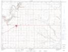
Maps showing Rattlesnake Lake, 12-8-W4, Alberta
Rattlesnake Lake is a Lake located in 12-8-W4, Alberta and has an elevation of 801 meters.
- Latitude: 49° 58' 51'' North (decimal: 49.9808333)
- Longitude: 110° 59' 46'' West (decimal: -110.9961110)
- Topography Feature Category: Lake
- Geographical Feature: Lake
- Canadian Province/Territory: Alberta
- Elevation: 801 meters
- Location: 12-8-W4
- Atlas of Canada Locator Map: Rattlesnake Lake
- GPS Coordinate Locator Map: Rattlesnake Lake Lat/Long
Rattlesnake Lake NTS Map Sheets