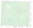
Maps showing Redrock Creek, 61-8-W6, Alberta
Redrock Creek is a River located in 61-8-W6, Alberta and has an elevation of 1060 meters.
- Latitude: 54° 17' 28'' North (decimal: 54.2911111)
- Longitude: 119° 11' 9'' West (decimal: -119.1858333)
- Topography Feature Category: River
- Geographical Feature: Creek
- Canadian Province/Territory: Alberta
- Elevation: 1060 meters
- Location: 61-8-W6
- Atlas of Canada Locator Map: Redrock Creek
- GPS Coordinate Locator Map: Redrock Creek Lat/Long
Redrock Creek NTS Map Sheets