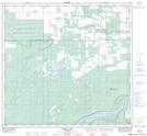
Maps showing Devil Lake, 108-17-W5, Alberta
Devil Lake is a Lake located in 108-17-W5, Alberta and has an elevation of 310 meters.
- Latitude: 58° 22' 24'' North (decimal: 58.3733333)
- Longitude: 116° 47' 23'' West (decimal: -116.7897222)
- Topography Feature Category: Lake
- Geographical Feature: Lake
- Canadian Province/Territory: Alberta
- Elevation: 310 meters
- Location: 108-17-W5
- Atlas of Canada Locator Map: Devil Lake
- GPS Coordinate Locator Map: Devil Lake Lat/Long
Devil Lake NTS Map Sheets