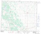
Maps showing Egremont, 25-58-22-W4, Alberta
Egremont is a Unincorporated area located in 25-58-22-W4, Alberta and has an elevation of 643 meters.
- Latitude: 54° 2' 18'' North (decimal: 54.0383332)
- Longitude: 113° 7' 34'' West (decimal: -113.1261111)
- Topography Feature Category: Unincorporated area
- Geographical Feature: Hamlet
- Canadian Province/Territory: Alberta
- Elevation: 643 meters
- Location: 25-58-22-W4
- Atlas of Canada Locator Map: Egremont
- GPS Coordinate Locator Map: Egremont Lat/Long