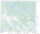
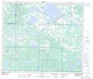
Maps showing Field Lake, 66-14-W4, Alberta
Field Lake is a Lake located in 66-14-W4, Alberta and has an elevation of 559 meters.
- Latitude: 54° 43' 42'' North (decimal: 54.7283333)
- Longitude: 111° 59' 17'' West (decimal: -111.9880556)
- Topography Feature Category: Lake
- Geographical Feature: Lake
- Canadian Province/Territory: Alberta
- Elevation: 559 meters
- Location: 66-14-W4
- Atlas of Canada Locator Map: Field Lake
- GPS Coordinate Locator Map: Field Lake Lat/Long
Field Lake NTS Map Sheets