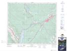
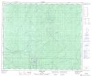
Maps showing William A. Switzer Provincial Park, 51,52-26-W5, Alberta
William A. Switzer Provincial Park is a Conservation area located in 51,52-26-W5, Alberta and has an elevation of 1140 meters.
- Latitude: 53° 30' North (decimal: 53.5000000)
- Longitude: 117° 48' West (decimal: -117.7999999)
- Topography Feature Category: Conservation area
- Geographical Feature: Provincial Park
- Canadian Province/Territory: Alberta
- Elevation: 1140 meters
- Location: 51,52-26-W5
- Atlas of Canada Locator Map: William A. Switzer Provincial Park
- GPS Coordinate Locator Map: William A. Switzer Provincial Park Lat/Long
William A. Switzer Provincial Park NTS Map Sheets