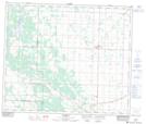
Maps showing Kerensky, 13-58-22-W4, Alberta
Kerensky is a Unincorporated area located in 13-58-22-W4, Alberta and has an elevation of 632 meters.
- Latitude: 54° 1' North (decimal: 54.0166666)
- Longitude: 113° 8' West (decimal: -113.1333332)
- Topography Feature Category: Unincorporated area
- Geographical Feature: Locality
- Canadian Province/Territory: Alberta
- Elevation: 632 meters
- Location: 13-58-22-W4
- Atlas of Canada Locator Map: Kerensky
- GPS Coordinate Locator Map: Kerensky Lat/Long