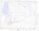
Maps showing Kinbrook Island Provincial Park, 18-14-W4, Alberta
Kinbrook Island Provincial Park is a Conservation area located in 18-14-W4, Alberta and has an elevation of 769 meters.
- Latitude: 50° 26' 4'' North (decimal: 50.4344444)
- Longitude: 110° 56' 30'' West (decimal: -110.9416666)
- Topography Feature Category: Conservation area
- Geographical Feature: Provincial Park
- Canadian Province/Territory: Alberta
- Elevation: 769 meters
- Location: 18-14-W4
- Atlas of Canada Locator Map: Kinbrook Island Provincial Park
- GPS Coordinate Locator Map: Kinbrook Island Provincial Park Lat/Long
Kinbrook Island Provincial Park NTS Map Sheets