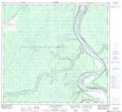
Maps showing Paddle Prairie, 18-103-21-W5, Alberta
Paddle Prairie is a Unincorporated area located in 18-103-21-W5, Alberta and has an elevation of 380 meters.
- Latitude: 57° 57' 4'' North (decimal: 57.9511111)
- Longitude: 117° 28' 20'' West (decimal: -117.4722222)
- Topography Feature Category: Unincorporated area
- Geographical Feature: Hamlet
- Canadian Province/Territory: Alberta
- Elevation: 380 meters
- Location: 18-103-21-W5
- Atlas of Canada Locator Map: Paddle Prairie
- GPS Coordinate Locator Map: Paddle Prairie Lat/Long
Paddle Prairie NTS Map Sheets