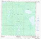
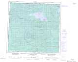
Maps showing Petitot River, 122-12-W6, Alberta
Petitot River is a River located in 122-12-W6, Alberta.
- Latitude: 59° 34' 56'' North (decimal: 59.5822222)
- Longitude: 120° 0' 5'' West (decimal: -120.0013888)
- Topography Feature Category: River
- Geographical Feature: River
- Canadian Province/Territory: Alberta
- Location: 122-12-W6
- Atlas of Canada Locator Map: Petitot River
- GPS Coordinate Locator Map: Petitot River Lat/Long
Petitot River NTS Map Sheets
084M11 Donna Creek Topographic Map at 1:50,000 scale
084M12 Dickins Lake Topographic Map at 1:50,000 scale
084M14 Creighton Lake Topographic Map at 1:50,000 scale
084M15 Kirkness Island Topographic Map at 1:50,000 scale
084M16 Thurston Lake Topographic Map at 1:50,000 scale
084M Bistcho Lake Topographic Map at 1:250,000 scale
084M12 Dickins Lake Topographic Map at 1:50,000 scale
084M14 Creighton Lake Topographic Map at 1:50,000 scale
084M15 Kirkness Island Topographic Map at 1:50,000 scale
084M16 Thurston Lake Topographic Map at 1:50,000 scale
084M Bistcho Lake Topographic Map at 1:250,000 scale