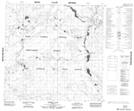
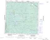
Maps showing Pierre Lake, 119-12,13-W4, Alberta
Pierre Lake is a Lake located in 119-12,13-W4, Alberta and has an elevation of 254 meters.
- Latitude: 59° 21' 37'' North (decimal: 59.3602777)
- Longitude: 112° 4' 28'' West (decimal: -112.0744443)
- Topography Feature Category: Lake
- Geographical Feature: Lake
- Canadian Province/Territory: Alberta
- Elevation: 254 meters
- Location: 119-12,13-W4
- Atlas of Canada Locator Map: Pierre Lake
- GPS Coordinate Locator Map: Pierre Lake Lat/Long
Pierre Lake NTS Map Sheets