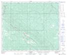
Maps showing Robb, 15-49-21-W5, Alberta
Robb is a Unincorporated area located in 15-49-21-W5, Alberta and has an elevation of 1118 meters.
- Latitude: 53° 14' 00'' North (decimal: 53.2333333)
- Longitude: 116° 58' 43'' West (decimal: -116.9786110)
- Topography Feature Category: Unincorporated area
- Geographical Feature: Hamlet
- Canadian Province/Territory: Alberta
- Elevation: 1118 meters
- Location: 15-49-21-W5
- Atlas of Canada Locator Map: Robb
- GPS Coordinate Locator Map: Robb Lat/Long