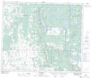
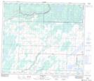
Maps showing Flat Creek, 66-19-W4, Alberta
Flat Creek is a River located in 66-19-W4, Alberta and has an elevation of 586 meters.
- Latitude: 54° 45' 25'' North (decimal: 54.7569440)
- Longitude: 112° 52' 20'' West (decimal: -112.8722220)
- Topography Feature Category: River
- Geographical Feature: Creek
- Canadian Province/Territory: Alberta
- Elevation: 586 meters
- Location: 66-19-W4
- Atlas of Canada Locator Map: Flat Creek
- GPS Coordinate Locator Map: Flat Creek Lat/Long
Flat Creek NTS Map Sheets