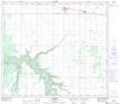
Maps showing Forest View, 19-75-20-W5, Alberta
Forest View is a Unincorporated area located in 19-75-20-W5, Alberta and has an elevation of 589 meters.
- Latitude: 55° 31' 7'' North (decimal: 55.5186110)
- Longitude: 117° 6' 10'' West (decimal: -117.1027778)
- Topography Feature Category: Unincorporated area
- Geographical Feature: Former Locality
- Canadian Province/Territory: Alberta
- Elevation: 589 meters
- Location: 19-75-20-W5
- Atlas of Canada Locator Map: Forest View
- GPS Coordinate Locator Map: Forest View Lat/Long