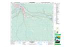
Maps showing Fort McMurray, 89-9-W4, Alberta
Fort McMurray is a Unincorporated area located in 89-9-W4, Alberta and has an elevation of 251 meters.
- Latitude: 56° 43' 35'' North (decimal: 56.7264000)
- Longitude: 111° 22' 49'' West (decimal: -111.3802999)
- Topography Feature Category: Unincorporated area
- Geographical Feature: Locality
- Canadian Province/Territory: Alberta
- Elevation: 251 meters
- Location: 89-9-W4
- Atlas of Canada Locator Map: Fort McMurray
- GPS Coordinate Locator Map: Fort McMurray Lat/Long
Fort McMurray NTS Map Sheets