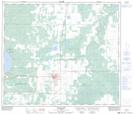
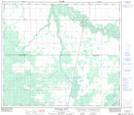
Maps showing Clouston Creek, Alberta
Clouston Creek is a River located in Alberta and has an elevation of 815 meters.
- Latitude: 55° 29' 8'' North (decimal: 55.4855555)
- Longitude: 117° 17' 28'' West (decimal: -117.2911110)
- Topography Feature Category: River
- Geographical Feature: Creek
- Canadian Province/Territory: Alberta
- Elevation: 815 meters
- Atlas of Canada Locator Map: Clouston Creek
- GPS Coordinate Locator Map: Clouston Creek Lat/Long
Clouston Creek NTS Map Sheets