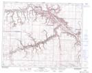
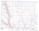
Maps showing Fox Creek, 29-20-W4, Alberta
Fox Creek is a River located in 29-20-W4, Alberta and has an elevation of 715 meters.
- Latitude: 51° 27' 53'' North (decimal: 51.4647222)
- Longitude: 112° 45' 39'' West (decimal: -112.7608332)
- Topography Feature Category: River
- Geographical Feature: Creek
- Canadian Province/Territory: Alberta
- Elevation: 715 meters
- Location: 29-20-W4
- Atlas of Canada Locator Map: Fox Creek
- GPS Coordinate Locator Map: Fox Creek Lat/Long
Fox Creek NTS Map Sheets