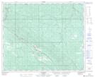
Maps showing Lovettville, 3-47-19-W5, Alberta
Lovettville is a Unincorporated area located in 3-47-19-W5, Alberta and has an elevation of 1358 meters.
- Latitude: 53° 2' North (decimal: 53.0332999)
- Longitude: 116° 41' West (decimal: -116.6833000)
- Topography Feature Category: Unincorporated area
- Geographical Feature: Former Locality
- Canadian Province/Territory: Alberta
- Elevation: 1358 meters
- Location: 3-47-19-W5
- Atlas of Canada Locator Map: Lovettville
- GPS Coordinate Locator Map: Lovettville Lat/Long