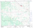
Maps showing Rochfort Bridge, 7-57-7-W5, Alberta
Rochfort Bridge is a Unincorporated area located in 7-57-7-W5, Alberta and has an elevation of 700 meters.
- Latitude: 53° 54' 49'' North (decimal: 53.9136110)
- Longitude: 115° 2' 11'' West (decimal: -115.0363889)
- Topography Feature Category: Unincorporated area
- Geographical Feature: Hamlet
- Canadian Province/Territory: Alberta
- Elevation: 700 meters
- Location: 7-57-7-W5
- Atlas of Canada Locator Map: Rochfort Bridge
- GPS Coordinate Locator Map: Rochfort Bridge Lat/Long
Rochfort Bridge NTS Map Sheets